Saturday, October 4, 2014

TRAVEL DAY 12


South of Moab
So, now we are in Moab, the place where we fought we'd catch the Canyonlands and the Arches National Park. We opted out of the Canyonlands, since we had seen so much unexpectedly  yesterday, but we had to see the Arches. Or so we thought...

Another surprise: Arches that did not happen to us. It turned out that the scenery was a hike away, and with my "disability" again, we had to abandon the ambitions of getting my own photos. So, I hubmly confess that this gorgeous picture is not mine. (Below)
More info on the Arches:

Arches National Park preserves over 2,000 natural sandstone arches, like the world-famous Delicate Arch, as well as many other unusual rock formations. In some areas, the forces of nature have exposed millions of years of geologic history. The extraordinary features of the park create a landscape of contrasting colors, landforms and textures that is unlike any other in the world. Arches is truly one of the most unique places on earth.


Having to retrace our tracks, it was a good opportunity to enjoy the beautiful rocky scenery again. And, and! We did see an arch right along the road! It is called "Wilson's Arch." (How did we miss this driving the other way?)


The rock formations continue to amaze and entertain us. This is called "The Three Gossips":


Actually I think this would be better named "Three Gossips"—I mean, look at those three faces, eyes closed and mouths open... Or maybe they are consoling each other?


Then there's this. Remember Bishop and Gaudí? Influence, possibly?


Family outing? I mean, Mommy, Daddy and 10 (?) kiddies? (Below)


And back...to


Mesa Verde

The experience of all experiences... Wasn't sure we'd make it there, but Frosty said, "Why not, we're passing right through." Well, "through" is not quite accurate. It's petty much off the road, in the mountains. Quite an adventure to drive 23 miles up to the top, countless hair-pin turns, with white-knuckled wife whining in woeful fear. (Not really; just a try at alliteration there...) But we made it! Of course, the best would have been to hike to some of the spots, but... as before. Luckily there were several stops that afforded breathtaking views of the old cliff dwellings. 


Amazing. I am so glad my dream to see this site is no longer a dream...

More from Wikipedia:

Mesa Verde National Park is a UNESCO World Heritage Site. It is the largest archaeological preserve in the United States. The park was created in 1906 by President Theodore Roosevelt to protect some of the best-preserved cliff dwellings in the world, or as he said, "preserve the works of man." It features numerous ruins of homes and villages built by the Ancient Pueblos peoples, sometimes called the Anasazi. There are over 4000 archaeological sites and over 600 cliff dwellings of the Pueblo people at the site.
The Anasazi inhabited Mesa Verde between 600 to 1300, though there is evidence they left before the start of the 15th century. They were mainly subsistence farmers, growing crops on nearby mesas.Their primary crop was corn, the major part of their diet. Men were also hunters, which further increased their food supply. The women of the Anasazi are famous for their elegant basket weaving. Anasazi pottery is as famous as their baskets; their artifacts are highly prized. The Anasazi kept no written records.
By the year 750 the people were building mesa-top villages made of adobe. In the late 1190s they began to build the cliff dwellings for which Mesa Verde is famous.
Some interesting sights along the way down towards New Mexico, our stopping place for the night:

"Chimney Rock" and "Balanced Rock"

Is that a sleeping elephant? And how would you name the other?

We observed something unusual up there on the mountains: dead forests!


The elevation was  8572 feet at the highest point. We both experienced popping ears ascending and descending. "I believe I can fly..."

And then,


NEW MEXICO: ALONG I-40
ARIZONA: METEOR CRATOR, JEROME


Friday, October 3, 2014

TRAVEL DAY 11


Odd day of unintended routes. What you see in the above map is literally far from what we had planned... Our  intended destination was actually Moab via Price. But that's a story to get into later. 

So we started from Sandy, where we had had a nice hotel for three nights, and drove south towards Price. At the mouth of the Price Canyon we found something odd: windmills. Odd, in that normally these windmills are high on top of a hill to catch the winds which liven the blades. These were at the mouth of the canyon, on the bottom of the hills (mountain). My in-house electric energy-expert explained that there is a strong wind current at the bottom of openings like this one.


In the mountains on the way  to Price:


Nine Mile Canyon
Near Price is what is called "Nine Mile Canyon," a fascinating place where some of the most spectacular rock art in Utah can be found. I was really looking forward to browsing through this wonderful art gallery. So I did some research and learned, aside from the history of this petroglyph site (i.e., the stories of people who lived there centuries ago), that "nine miles" really is actually 46 miles and "a wilderness area." That was a red flag  for people like us (especial for me, due to my injured knee and leg...) So we opted to delete this site from our agenda. But, as the place is so fascinating,  I will post a couple of pictures from http://www.thelivingmoon.com (under their "Fair Use" agreement).  The Nine Mile Canyon is a unique international treasure.


Drive-through Price
We were hoping to find the old Tabernacle that seemed very interesting architecturally. We figured a building such as a tabernacle in a Mormon town ought to have a prominent site, but after driving around a bit, we decided to stop at the Institute Building on the University campus. We found a bunch of young students in an informal setting and asked them  about the  location  of
the Tabernacle. The answer: it was torn down decades ago... Note to self: do more research before you go diving to unknown places. 

But never mind, we found something to represent a small-town USA (=some nice architecture):


One more example of the wisdom in the above statement. Let's see the route that we thought we were going to follow:


And then the route we drew after the fact that shows our path:


That "detour" added almost three hours to our day, but boy! was it worth it!

The reason for going to Moab was to visit the Canyonlands and Arches National Parks. Without any more information than that they are close to Moab, we took off and were going to play it by ear... Ear out of tune, I guess, for we ended up the road to Hanksville and just followed it. I'm glad we did!

Glen Canyon

We had not planned on seeing Glen canyon because it was too far... but we ended up driving through it. What a celebration of rustic, rugged beauty! "Nature's way of making Liisa happy," said Frosty. 

Glen Canyon is one of Nature's most impressive works involving water erosion over a long, long timethey say "millions of years." It is a National Recreation Area that offers unparalleled opportunities for water-based and backcountry recreation. It encompasses 1.2 million acres of the Colorado Plateau, a vast landscape of colorful buttes, mesas, canyons, and cliffs. Arid to semi-arid, the region supports a complex and often fragile ecosystem. Plants and wildlife have developed unique adaptations to the hot, arid conditions of their environment and contribute to the rich diversity of life in the area. 

Two overall photos of the Canyon:


I am not able to explain every picture I took—hundreds of them—so I will just include several of the trip through the Canyon.


Some fun details, though all may not be in Glen Canyon—I cannot remember all exactly. We were pondering what all the promontories and cliffs etc. were called, possibly named by people who traveled by them, and lo and behold, we found at least these, for example:

The "Salt Box"


"Mexican Hat" (Picture not mine)


"Jacob's Chair"


Natural Bridges

“Three majestic natural bridges invite you to ponder the power of water in a landscape usually defined by its absence. View them from an overlook, or hit the trails and experience their grandeur from below. Declared a National Monument in 1908, the bridges are named ‘Kachina,’ ‘Owachomo’ and ‘Sipapu’ in honor of the Native Americans that once made this area their home.”
These bridges and other similar features present on the Colorado Plateau today were molded by the processes of erosion. The destructive forces of wind and rain, running water, and freezing temperatures attacked the uplifts as soon as all the tectonic havoc started in the Late Cretaceous. (Did you get all that?)


Blanding


Aptly named "base Camp," for Blanding's location is ideal for short trips to National Parks. (We did not stop here. I just liked the slogan.)

Monticello
Monticello is in the lit, for there is an Indian ruins and petroglyphs place nearby called Butler's Wash. Funny thing, but I knew the word in Arabic before I knew what it was in English: wadi, which means wash, as in dry basin or stream.

Anyway, this is what Butler's Wash has to offer. (We did not go there for the reason of my "disability," but I want to include a picture what to had to offer--not mine):
Another notable point of interest in Monticello was the LDS Temple. What a surprise to spot it!


 Seen on the way to Moab (finally).


Moab
The Biblical name Moab refers to an area located on the eastern side of the Jordan River. Some historians believe the town in Utah came to use this name because of William Pierce, the first postmaster, believing that the biblical Moab and this part of Utah were both "the far country." Some of the area's early residents attempted to change the city's name because in the Christian Bible, Moabites are demeaned as incestuous and idolatrous, but it was never accomplished.

Nowadays, Moab is the gateway to a whole host of geological treasures.


COLORADO: MESA VERDE CLIFF DWELLINGS


Wednesday, October 1, 2014

NO-TRAVEL DAY 2


Today's activities took us to Provo—actually a real "travel day"—down the Memory Lane. I guess we have lived away from Provo long enough for it to invite us to trace our steps from our university days to the time we actually returned there to live. 
The first stop was at the Provo Canyon to see a “semi-sacred” place for our family: the site of the old Provo Canyon Power Plant. Frosty’s grandfather, who was in the first graduating class at Cornel University in Electrical Engineering in 1901, worked at the hydroelectric power plant until 1905. The station began generation of power at the end of 1897. We have pictures of all the equipment, such as the turbines and control panels, and the long flume that ran down the mountain side in Provo Canyon. (Some of our friends might remember seeing that “eye-sore.”) The Utah Historical Society eagerly copied all our photos, but they are not accessible for me to use now. The flume has now been taken down. To our knowledge, the Provo Canyon power plant had the longest transmission lines in America.

Below, the old and the present...


This is the flume that followed the mountain side carrying water for the plant... now gone. Remember it well!


While in the canyon, we went to see the Bridal Vail Falls. Not much of a spectacular this time of year, I guess. And where is the gondola that took people up to the top? And the little shop near the parking lot? This is all that is left?


On to the old campus! Not at all what it was even ten years ago when we lived in Provo for a while after Frosty retired. This is where we left on our mission to Dubai and then moved to Pinehurst.

Anyway, the campus. Not the same... You can never go back. Amazing growth.


My home away from home: the Harris Fine Arts Center. How many times did I climb those stairs and how many hours daily did I spend in the practice rooms in the basement?


Madsen Recital Hall where I gave my Senior Recital... in 1970...


From BYU "tour" we started our "home tour." My first home (room) on top left, Frosty's, on top right. Then our first apartment in Provo was in the old Provo mayor's house, upstairs. The stairs on the outside, right, took us to our little apartment. The photo on bottom right is how the house now looks. It now houses a reception hall.


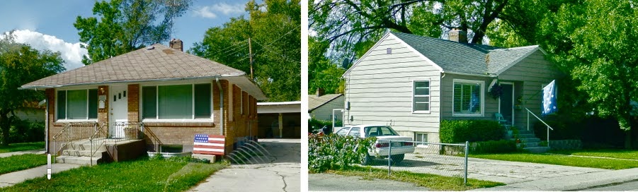
And a couple more homes. On the left is our condominium that we had when all our children were going to BYU, though they did not live there. It was actually my pied-à-terre when we lived in Dubai to escape all that unbearable heat in the summertime.  

The house on the right was our home for a few months after retirement and before leaving on our mission to Dubai. And then after the mission, we moved to Pinehurst.


Continuing our way towards our friends' house, we passed the new Provo City Center Temple. It was covered with scaffoldings, so we could not get a good picture of it. I did find one on line. I think it is an artist's rendition.


Truly an inspiring building!

And so are these. Unusual classic architecture in the middle of good old Provo!


Forever friends from long time ago... Rosemary was (is) an accomplished pianist and I was lucky to have her be my accompanist for many years when we lived in New York. It was great to see them again.  They are the nice people who let us use their home and car when were waiting to get our visas to Norway before our mission there. Photo on the left taken the night before we traveled to Norway. And the other, well, we're forever young...


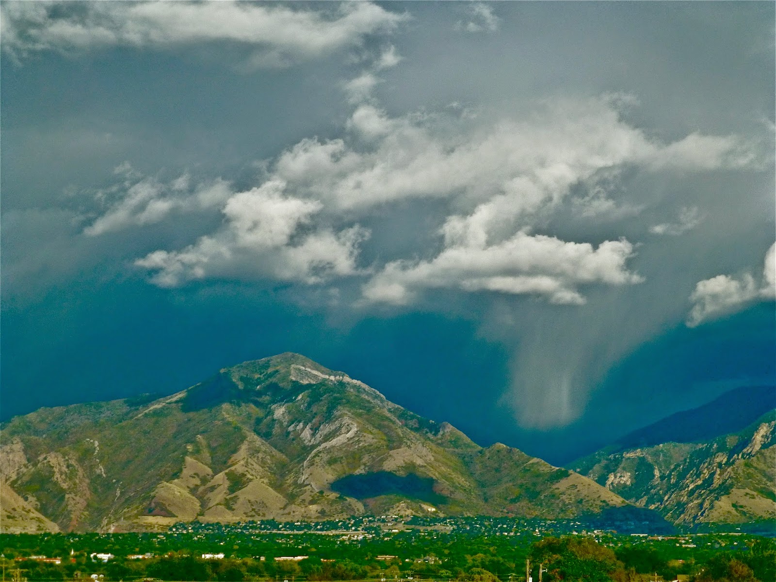
On the way to make our final visit, this was a beautiful view of Salt Lake City:


Today's final visit was to friends we knew in Saudi Arabia. We are so blessed to have so many wonderful friends from all phases of our lives... particularly mine, since this blog is all about me... Jack and Leslie are fantastic friends. Interestingly, Jack and Frosty both served their young missions in Noway, which fact was an instant bond. Good times!


What a wonderful two days we had in Happy Valley! So many beautiful memories and dear friends who have enriched our lives immeasurably. Thank you all!


UTAH CANYONLANDS: 
"NATURE'S WAY OF MAKING LIISA HAPPY"
PRICE, PETROGLYPHS, GLEN CANYON
NATURAL BRIDGES, MOAB